
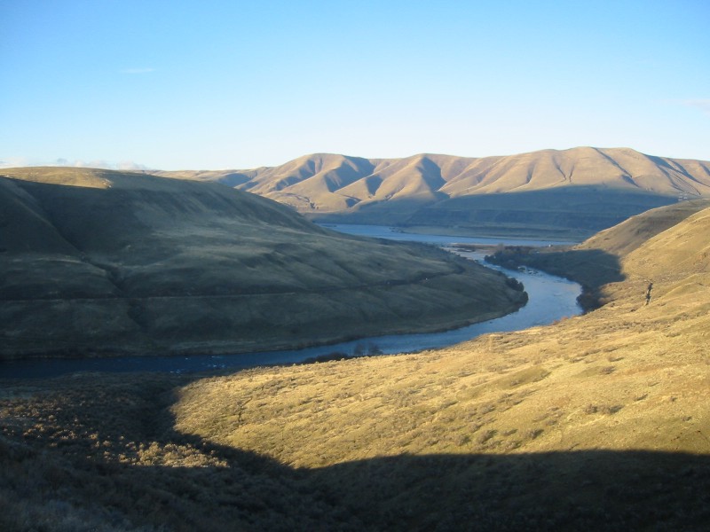
The Deschutes River doesn’t just run through Bend — it defines the city. Stretching roughly 252 miles from its headwaters near Crane Prairie Reservoir to its confluence with the Columbia River, the Deschutes serves as the backbone of Central Oregon’s ecosystem, economy, and outdoor culture. For Bend residents, the river is both a daily landmark and a dynamic natural system shaped by volcanic geology, snowmelt hydrology, and the high desert climate of the eastern Cascade slopes.
Origins and Hydrology
The Deschutes originates in the Cascade Range, fed by snowmelt and underground springs filtered through layers of porous volcanic basalt. This lava rock acts as a natural aquifer, releasing groundwater steadily throughout the year and giving the upper Deschutes an unusually stable flow compared to other Pacific Northwest rivers. According to the U.S. Geological Survey, this spring-fed character keeps water temperatures consistently cool — a critical factor in supporting native species like the redband trout.
Bend sits at roughly 3,600 feet elevation in a semi-arid climate averaging fewer than 12 inches of annual precipitation, which means the river carries enormous ecological weight for the region. Spring runoff typically peaks between April and June, elevating flows that local paddlers and anglers track closely each year.
Ecological Significance Along the Bend Corridor
Within city limits, the Deschutes River Trail traces more than 11 miles of riverbank through ponderosa pine forests and high desert sagebrush. This corridor supports osprey, great blue herons, river otters, and mule deer. The Oregon Department of Fish and Wildlife classifies the stretch between Wickiup Reservoir and Bend as one of Central Oregon’s most productive fisheries, particularly for wild rainbow trout.
Riparian vegetation — the plants growing along riverbanks — plays a stabilizing role that often goes unnoticed. Willows, alders, and native grasses anchor the soil, filter stormwater runoff, and moderate water temperatures through shade. Invasive species like reed canarygrass and recreational overuse can disrupt this plant community, accelerating bank erosion and degrading water quality downstream.
Recreation and Physical Demands on the River
The Deschutes is among Oregon’s most heavily used recreational waterways, drawing kayakers, stand-up paddleboarders, fly fishers, and trail runners year-round. The Bend Whitewater Park at McKay Park — a publicly engineered facility completed in 2015 — features adjustable hydraulics that accommodate a range of skill levels, from beginner surfers to experienced kayakers.
Year-round activity along the river places real physical demands on participants. River sports, trail running on uneven terrain, and repetitive fly casting engage the knees, hips, shoulders, and lower back — areas frequently affected by overuse injuries, prior trauma, or age-related joint degeneration.
Cold water temperatures can remain below 50°F even in summer due to the spring-fed hydrology, increasing muscle stiffness and elevating injury risk for those with pre-existing musculoskeletal conditions. The Oregon Health Authority notes that musculoskeletal strains and fractures represent a significant share of outdoor recreation-related emergency visits in Deschutes County each year.
Water Rights and Governance
The Deschutes basin operates under Oregon’s prior appropriation water law — often summarized as “first in time, first in right” — which allocates water based on historical use priority. The Oregon Water Resources Department administers these rights, determining how much water irrigators, municipalities, and environmental trust holders can draw in any given year.
The Deschutes River Conservancy has worked since the 1990s to restore instream flows by purchasing or leasing water rights from agricultural users and returning that water to the river. These transactions have measurably improved late-summer flows in stretches historically depleted by irrigation, benefiting both aquatic habitat and the recreation economy. The Bureau of Reclamation also manages several upstream dams on the system, and their operational decisions directly shape the volume and timing of water moving through Bend each season.
As one of the fastest-growing metros in the U.S. throughout the 2010s — per U.S. Census Bureau data — Bend has faced increasing pressure on regional water resources, making responsible Deschutes management central to the city’s long-term planning.
A Year-Round Community Asset
For Bend residents, the Deschutes is not a seasonal amenity — it is an active resource that shapes the region’s identity, physical culture, and environmental future. Understanding its hydrology, ecology, and governance helps the community engage more responsibly with the river and appreciate why it remains, after decades of urban growth, the defining natural feature of Central Oregon.